map Lafayette cartographer

a passion for the art of mapmaking

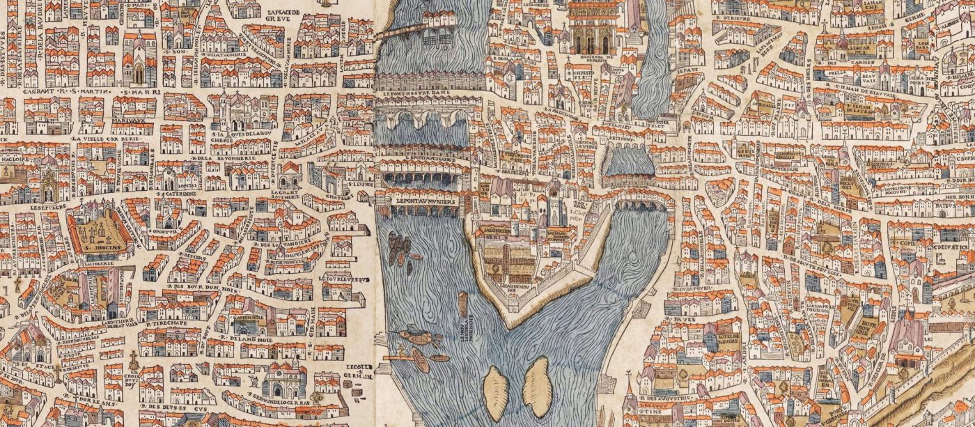
If you are passionate, just like I am, about the aesthetics of XVI-XVIII century maps, during this crucial transition period between so-called “artistic” manuscript maps and printed maps, you will find here the results of my research.

Research what has been written and published on:

  • Mineral and organic colors and pigments
  • Printing techniques: printmaking and engraving, etc.
  • Illustrations and symbols
  • Perspectives used
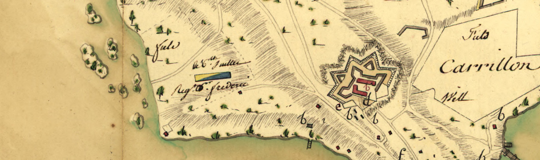
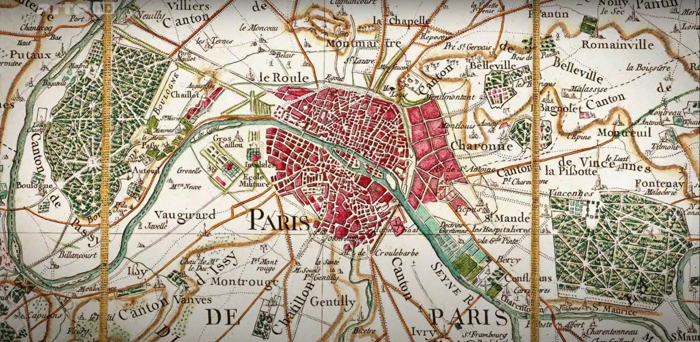
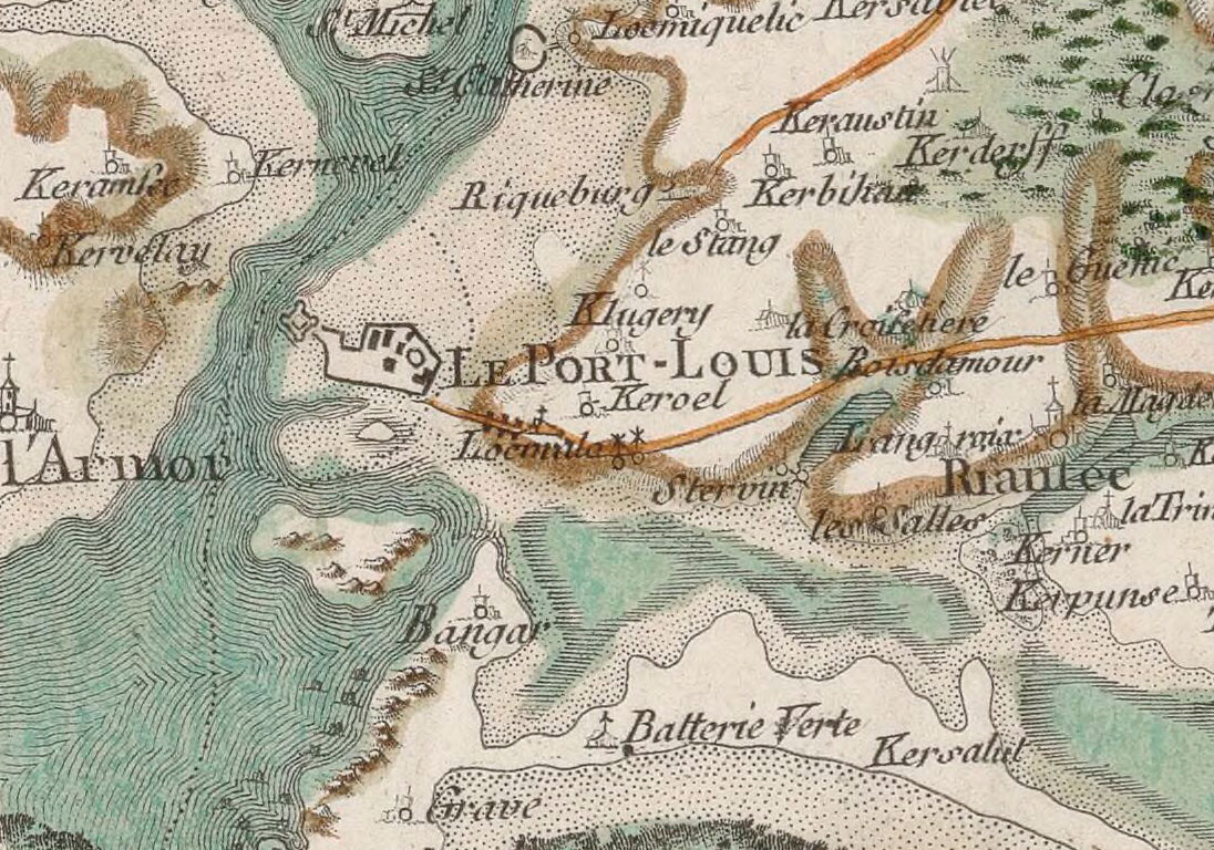
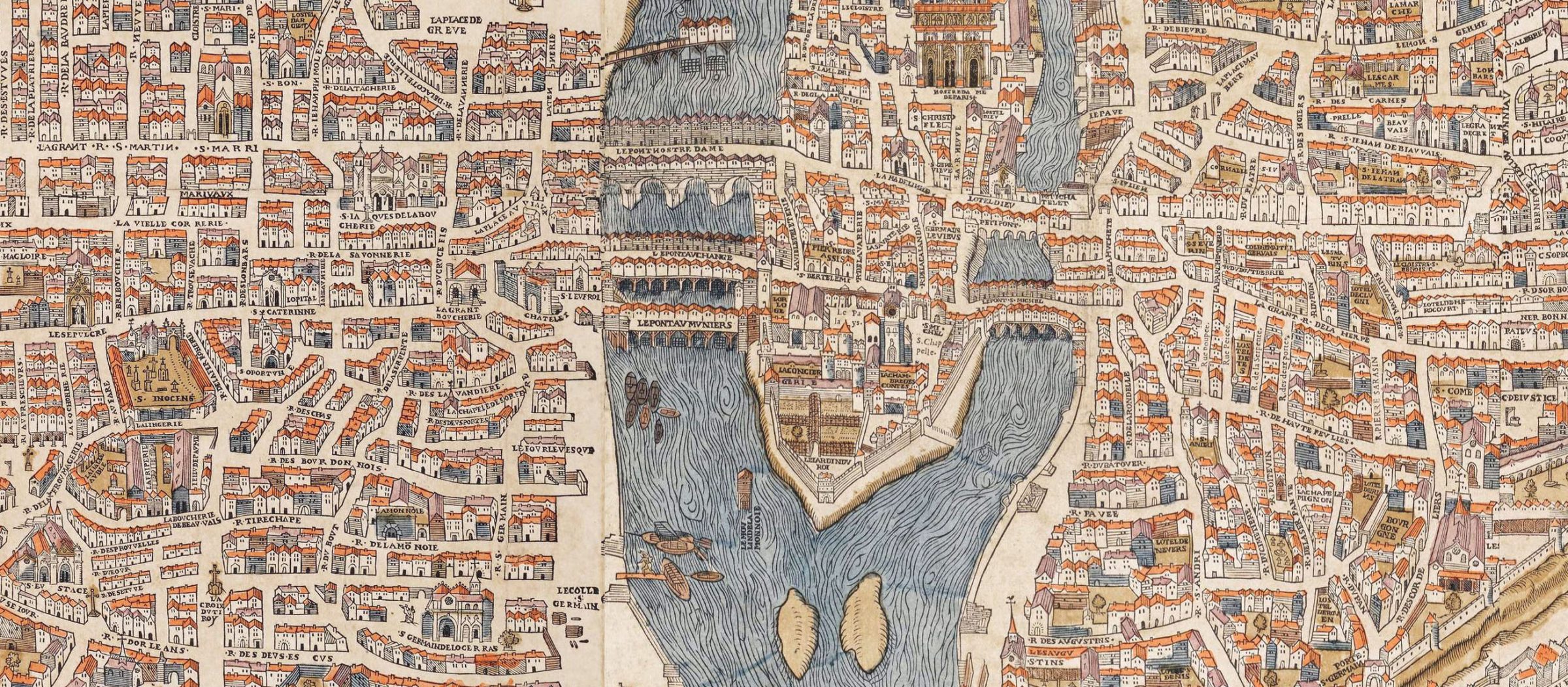
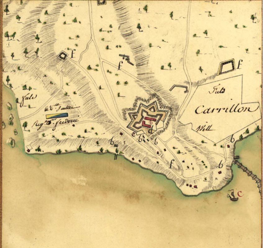
  • Maps roles and functions: cadastres and litigation, military maps, nautical maps, maps of explorers’ discoveries, city plans, fortifications plans
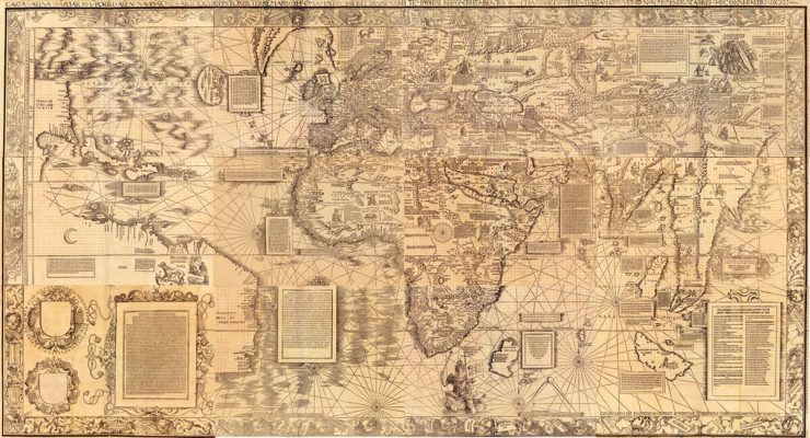
  • Famous maps and cartographers
  • Publications, books, articles, videos, and exhibitions on the art in maps

You will also find information on the explorers of that period and their journeys, on maritime fortifications and their architects, and the development of colonies by Europeans, as all this played an essential role in the production of maps at that time.

Aren’t maps the best testimony to these human adventures?

Cartography is a science, but it is also an art, and in the 17th and 18th centuries, many artists created maps; it is up to us to discover, explore and admire them.

colors & pigments

Since prehistoric times, men have made colors from minerals and plants.

They travel the world to find these sometimes precious ingredients, and the artists grind and mix them in their workshops. They learned how colors react to each other. The first color manufacturers appeared in the middle of the 17th century. Experts say that sometimes the knowledge of the illuminators of the Middle Ages was even lost during the next centuries when the artists stopped making their colors themselves. By understanding colors, pigments, and their interactions with papers, we understand better why the blue sea has become green today and why this red symbol is now white.

We also need to study the symbolism of colors. With the advent of printed maps, there was a standardization of colors in cartography, as evidenced by textbooks written at that time. Finally, we need to understand how artists applied colors to paper and the particular challenges cartography poses when it comes to manuscript or printed color maps.

And then, new binders are developed, which make the paints dry less and which will allow artists to leave their studios. I imagine the cartographer Mr. Capitaine, aide-de-camp to the Marquis de Lafayette, painting the valley of Lake Champlain and Fort Ticonderoga, in 1777.
let's explore this world of colors in maps

the techniques

From handwritten maps, in ink and watercolor, to wood- or lead-engraved printed maps, sometimes enhanced with watercolor, there is a whole world of techniques to discover.

Do you know that you can guess the engraving technique by studying the details of a map?

Carte Port-Louis Cassini

At the beginning of the 17th century, the Dutch were the first to master the techniques of map printing. No wonder Vermeer often depicted maps in his paintings. Isn’t this a way to pay tribute to their talent? Later, all of Europe saw the birth of map printing shops. They produced atlases, such as the Petit Atlas Maritime de Bellin, large wall maps, or nautical charts that accompanied explorers around the world. Let’s discover their names and their achievements.

Let’s also talk about the techniques of applying washes in watercolor, the different perspectives artists used, and the evolution of such techniques during the 17th and 18th centuries.

Finally, let’s discover how to reproduce these 18th-century engraved maps. I will show you the different printing techniques, with their specific materials and equipment.

Discover map-making techniques

“The real journey of discovery is not seeking new landscapes, but having new eyes.”

– Marcel Proust

the cartographic artists

Some famous cartographers are known for the technical innovation of their maps or the new territories they mapped.

And there are the cartographic artists, if you can call them that.

Some are more artists than cartographers (the term cartographer only appeared in the 19th century, after all), and others are more cartographers than artists. Some are famous, and some are not.

Let’s discover together these cartographers and their magnificent maps: this map of Paris from 1550, from Truschet and Hoyau with its ocher and red houses; those gardens designed by Chaussegros de Léry in the plans of Montreal and Quebec, in New France; the pastel blue and hatched waves of the Gulf of Morhiban on a Cassini map; and many others. I liked the precision of the line, the harmony of the colors, and the bird’s eye view that made those maps so alive.
Let us discover these artists and their maps

the role of maps

Since the dawn of time, men have created maps. The first hunters drew their hunting territory. Men wanted to explain the world. Maps helped explorers and traders who went to Asia looking for spices.

In the Middle Ages and the Renaissance, maps were appendices in court cases when nobles or clerics contested land use. The scales were not always exact, and the perspectives were varied, but their aesthetics are indisputable.

Later, in the 17th-18th centuries, maps testify to the development of the great colonial empires when the Portuguese and Spanish shared the world. The world maps illustrate the new lands discovered by explorers. Nautical charts guide navigators. The King’s engineers drew the colonial cities and their expansion.

The maps also document excellent technical or architectural achievements, such as the Canal du Midi (1681).

Finally, maps can have an essential military role. There are plans of fortifications made by military engineers or the campaign plans of the many wars the world has seen.

The years pass, and maps represent the territories more and more accurately. Do they also lose some of their artistic quality? You can be the judge.

Let us discover the roles of maps
learn more
learn more
learn more
learn more
come and discover

Latest articles

Colors in 17th and 18th centuries’ maps

What were the pigments and colors used in hand-made or printed and color-enhanced maps 17th [...]

read more
Carta Marina 1516 : A New Approach to Mapmaking

"For his 1516 "Carta Marina" world map, the German cartographer Martin Waldseemüller completely changed his [...]

read more
Maps: La California as an island

Over 40 years, Glen McLaughlin, a Californian venture capitalist, bought nearly 800 maps showing California [...]

read more
contact me

Any question?

contact me